Holbox Island Map
You can click on extend screen on the “Holbox Island Map” to use the map in fullscreen and be able to filter the sites by map categories such as ATMs, gas stations, energy stations for electric vehicles, archaeological sites, Hospitals, Holbox Ferry, Yucatan cenotes, services and “things to do in Holbox Island” and things to do throughout the Yucatan Peninsula, Holbox Restaurants, Holbox mexican grill, Holbox Beaches and more.
Holbox Island
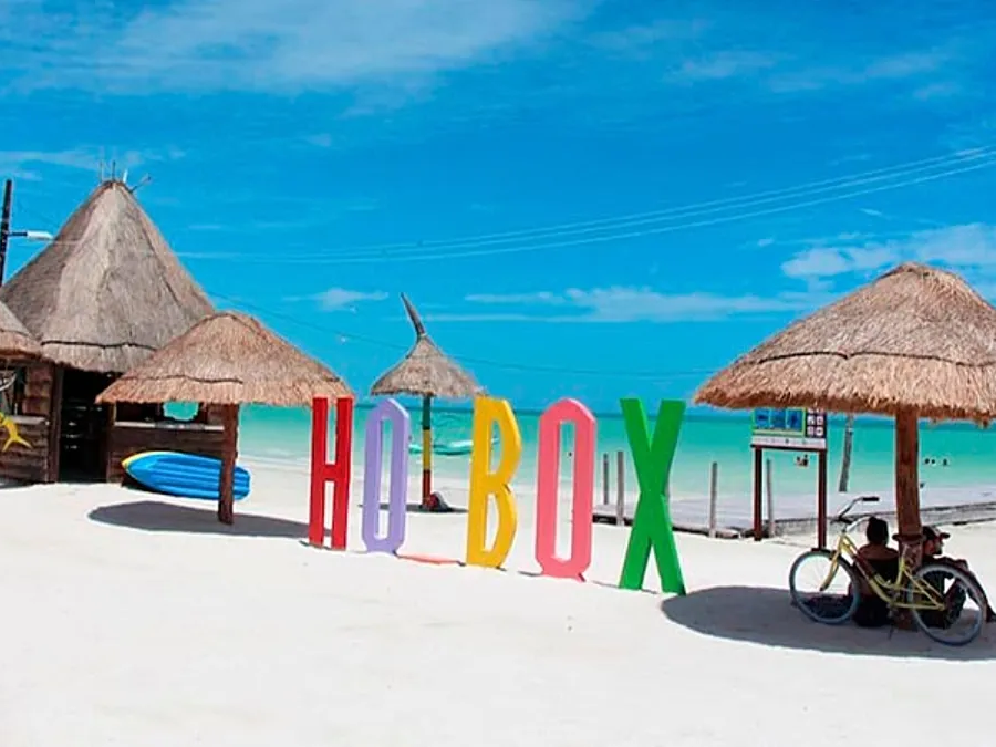
Holbox in Mayan means “black hole”, Holbox is a Mexican island located north of the Yucatan Peninsula, it is located inside the state of Quintana Roo and has an extension of 40 km long and 2 km wide with about 34 km of beach towards the North. The population of Holbox is approximately 1,200 inhabitants according to the 2005 census.
Holbox is a destination of adventure and also rest tourism. One of the main activities of the inhabitants of Holbox Island is lobster fishing governed by a ban. Holbox white sand walks along with its crystalline sea are comforting.
Hotels in Holbox
There are different Hotels in Holbox and sites to make camping, A lot of hotels in Holbox have Bungalows. There are famous villas and hotels in Holbox like villas flamingo holbox and mystique holbox. You can see it in the Holbox Island Map.
Holbox Island attractions
Yalahu in Holbox Island
It is located 30 minutes from Holbox Island, it is a spring of crystalline waters that contains as much beauty as history is said that this spring has healing properties so this beautiful water eye is considered as the source of youth, formerly it was a port Merchant important for the state of Quintana Roo. You can see it in the Holbox Island Map
Isla Pájaros (Birds Island) in holbox island
Isla Pajaros is a small islet covered with mangrove and cactus located in the Yalahu lagoon, on this island they inhabit a great diversity of birds so there are 2 viewpoints and walkers in order to minimize direct contact with birds , the birds that can be observed from the Isla Pájaros are the flamenco, cormorant, frigates, pelicans, wild gaviotas coma among many more. You can see it in the Holbox Island Map.
Isla Pasión in Holbox Island
Isla Pasion is a small islet that is 10 minutes from Holbox by boat as on this island you can enjoy virgin beaches with a quiet atmosphere and far from civilization. You can see it in the Holbox Island Map.
Cabo Catoche in Holbox Island
In Cabo Catoche is a tip on the coast of the Gulf of Mexico that is approximately 53 km north of Cancun, during the colonial era a Catholic temple was built which is known as Boca Church Punto there are no passable paths to arrive through Cabo Catoche, can only be reached by sea and you can also visit the ruins of Boca Church. You can see it in the Holbox Island Map.
Holbox Island History
Holbox Island has been inhabited since time immemorial by the Mayan Civilization.
In the nineteenth century the Holbox Island received many survivors fleeing from the Mayan social rebellion known as the caste war and in 1891 the inhabitants of Holbox formed the party of the islands based in Isla Mujeres.
The federal territory of Quintana Roo was created, so Holbox Island was integrated as a sub -prefecture of the Northern District, in 1910 the population of the state was grouped into 8 municipalities that were divided into 3 areas that still persist: north, center and south; The northern zone included the municipalities of Holbox, Cozumel and Isla Mujeres, at that time Holbox Island was the municipal head of 8 locations but shortly after in 1921 Isla Mujeres absorbed them.
It is a natural refuge of several species both in danger of extinction and threatened and most inhabitants are interested in protecting this area. Reason why Holbox Island host sustainable tourism projects looking for a minimum impact on the various ecosystems such as endemic fauna and vegetation in the area; Within the island there is no pavement and there are few cars, all the streets are of white sand which allows pedestrian displacement, traditional transport media are electric, gasoline and bicycle carts.
VIVA MEXICO !
During the colonial era a Catholic temple was built which is known as Boca Church. There are no passable paths to arrive through Cabo Catoche, can only be reached by sea.
In Cabo Catoche is a tip on the coast of the Gulf of Mexico that is approximately 53 km north of Cancun, during the colonial era a Catholic temple was built which is known as Boca Church. There are no passable paths to arrive through Cabo Catoche, can only be reached by sea and you can also visit the ruins of Boca Church. You can see it in the Holbox Island Map.
See amazing Tours available in Riviera Maya
Related Articles
Mayan Train Map
Mayan Train Map You can click on extend screen on the “Mayan Train Map” to use the map in fullscreen and be able to filter the sites by map categories such as Mayan Train Route (under construction) highlighted in Yellow, ATMs, gas stations, energy stations for...
Yucatan Peninsula Map
Yucatan Peninsula Map You can click on extend screen on the “Yucatan Peninsula Map” to use the map in fullscreen and be able to filter the sites by map categories such as ATMs, gas stations, energy stations for electric vehicles, archaeological sites, Hospitals,...
Quintana Roo Mexico Map
Quintana Roo Mexico Map You can click on extend screen on the “Quintana Roo Mexico Map” to use the map in fullscreen and be able to filter the sites by map categories such as ATMs, gas stations, energy stations for electric vehicles, archaeological sites, Hospitals,...
Tours to Holbox
Stay Up to Date With The Latest News & Updates
Follow Us
Follow us to be updated about useful content in Riviera Maya
